Introduction
The Kelchalpe Deposit is situated within the municipality of Aurach, on the right slope of the Wieseneggbach valley (Neinavaie et al., 2001). Its strike end extends below the range of hills located between Laubkogel (1760 meters) and the southern Saalkogel (2007 meters).
The exploration area is easily accessed by well-maintained forestry roads and hiking trails, with welcoming Alm & chalet accommodation available during summer. The land is sparsely populated and primarily used for agriculture and forestry work. There is no skiing within the licence area & the key mineral targets are several km out of sight and sound of any settlements, ski operations or tourist attractions.
Large historic mine waste dumps are a noted source of water pollution, their removal could be of benefit to the local population and environment. The dump material is loose at surface covering a large area, grades up to 3% copper with cobalt and gold credits and is easily accessible by road.

Photo of the Wildalm waste dump, which covers some 500m of ground at surface.
History
The Kitzbühel area in the Austrian Alps boasts a rich and significant mining history that has profoundly shaped its economic and cultural trajectory. With origins dating back to ancient times, the region's role as one of the oldest and most important mining centres in Central Europe has been a driving force behind its settlement development and economic prosperity (Heinisch et al., 2015).
Notably, prehistoric copper ore extraction during the Bronze Age laid the groundwork for mining activities that reached their peak during the late Middle Ages and the early modern era. As the centuries progressed, the mines witnessed periods of closure and revival, culminating in the nationalisation of mining operations in the 17th century. By the end of the 18th century, only the Kupferplatte (German for “Copper Plate”), Kelchalpe/Wildalpe, Schattberg/Sinnwell, Gebra-Lanern, Foidling-Hochalpe and Röhrerbühel mines remained as major operations in the Kitzbühel-Jochberg-Hochfilzen area.
The 19th century brought forth more detailed records of production, highlighting the intricate workings of the mines (Heinisch et al., 2015). In 1830, the Kupferplatte mine had a total basic network of 16,579 metres and shafts of 2,243 metres. After the mid-19th century, the Kelchalpe mine reached its greatest extent with a total of 5.5 km and was the most productive copper mine in the entire Kitzbühel area.
Copper and iron ore production gained prominence, between 1930 & 1945, due to increased demand for raw materials. Iron ore was produced at Gebra-Lannern and Foidling-Hochalpe (Heinisch et al., 2015).
In 1925, magnesite deposits were also discovered nearby on the Weissenstein and the Rettenwand near Hochfilzen (Heinisch et al., 2015). With the RHI Magnesita (Veitsch-Radex GmbH & Co OG - LSE: RHIM) operating the magnesite factory and mine from 1977 onwards, contributing substantially to Austria's raw magnesite production. In 2012, almost 21 % of Austria's total raw magnesite production came from the Weissenstein mining district (Pestal et al. 2015).
Geology
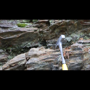
The area is within the Glemmtal geological unit, dominantly characterised by metabasite formations (Neinavaie et al., 2001). These metabasites consist of about 50% metabasalts with pillow structures, which also form prominent mountain peaks, and contribute to the steep alpine morphology in this region. Laterally, these basalt formations, along with their tuffs, interlock with the Wildschönauer Schiefer (Wildschönau schist).
Background sedimentation consists of distal turbidite facies pelites, with occasional minor coarse sandstone layers. Historically exploited ore deposits are almost all located at the boundary between basalt formations and the Wildschönau schist and are structurally controlled by valley scale faulting.
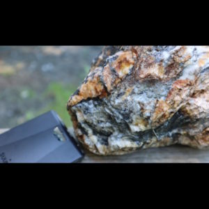
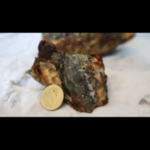
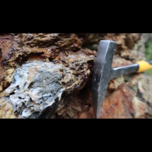
The chalcopyrite-pyrite deposits with secondary Ni-Co mineralisation, accompanied by quartz, Fe-carbonates, and red ironstone mineralisations, makes this deposit comparable to the Lahn-Dill type of Central Germany.
The Kelchalpe deposit is part of a larger mineral deposit range that extends from the Kelchalpe, across the Bachalpe, to the Wildalpe, covering a total length of nearly 3km within EMEX’s licence area. Mostler (1983) also suggests a connection between this deposit and the adjacent hematite-siderite deposit of Hochalpe-Foidling to the northeast.
Work Completed
In 2023 Ekometall Exploration began assessment work across the Kelchalpe licence area. The primary goal of this was to understand if the historically mined copper and gold systems could be economic for modern development.
Initial meetings were held with local mayors and non-intrusive surface sampling/mapping of the historic mine workings was completed above-ground by a small team of geologists between June & August 2023. The work followed historic maps to confirm the existence of workings and waste dumps.
Summary
Results from assessment of the Kelchalpe licence area indicate that copper, gold & cobalt may exist here in economic quantities. Following the 2023 campaign, EMEX consider the Kelchalpe region to be prospective for an appropriately sized discovery of high-grade ore. Following assessment, we do not believe a well-managed underground development here would interfere with the local environment, tourism, or community and could be realistic for future development. Considering especially that many underground operations already exist and operate successfully in the local area.
Future Work
To better evaluate the scale of underground orebodies EMEX plan to fly a regional aeromagnetic survey and run a ground-based IP survey of known orebodies. This will be run alongside detailed field mapping and baseline environmental studies, which are required to secure any future drilling permits.


