
Introduction
The Großarl licence area covers 6 key targets in Land Salzburg which were industrially mined in the past, these include. The licences are covering southern part of Großarl valley and the ridge between Großarl and Bad Gastein municipalities. Exploration licence terminates on the boundary of Hohe Tauern National Park in the south. The licences are in the mountainous terrain, in elevations ranging from about 900 mRL down in the Großarler-Ache valley up to 2467mRL at Gamskarkogel on west side of the licence and 2432mRL Glingspitze on east side of the licence.
Road access and hiking trail access is generally good, with roads maintained by the Budesforste (Forestry Service). Most historical mine sites and outcrops can be reached by 4WD vehicle and/or on foot, with the exceptions of Kree area in the southeastern part of the licence and Himmelwand near Bad Hofgastein which will rely on helicopter access, should they merit further investigation.

History
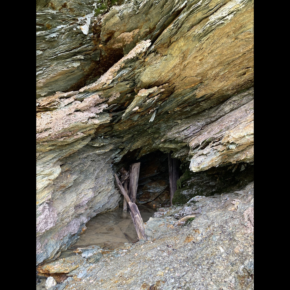
Mining activity in Großarl area dates back to the 11th century with the earliest mining reported at the ‘Schwarzwand’ prospect. Mining focused on extraction of pyrite rich ore as a source of sulphur. Copper was likely recovered as a by-product after sulphur extraction. Peak production was recorded in 14th and 17-18th centuries. The most important centres of historical mining in Großarl area were Karteis, Schwarzwand and Tofern. Most of the mines were shut down by the end of 19th century, Weber (1997) estimates total copper production from all mines in the Großarl Valley to 6500t with an average copper by-product content of 1.4 %. Several prospects in the Großarl Tal were evaluated in 1947 by the Studiengesellschaft Kiesbergbau. More recently, the Schwarzwand ‘Unterbau im Thal’ adit was open to the public as a tourist attraction.
Geology
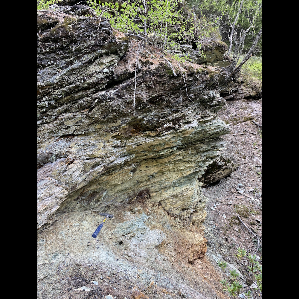
The geology of Inner Großarl Valley is dominated by a volcanosedimentary sequence of up to 1,000 m thick. (Jurassic-Lower Cretaceous Bündnerschiefer Formation). Black phyllites with intercalation of sericite-chlorite phyllites, quartz phyllites and sericite-quartzites are widespread especially in the hanging parts in the north.
A typical feature for the area with ore deposits is the occurrence of alternating sequence of green weakly metamorphosed metabasalts (prasinites) and calcareous mica schists to calcareous phyllites with intercalated marble beds. Green, weakly metamorphosed metabasalts are widespread in the eastern Tauern window and reach their greatest extent and thickness in the Großarl Valley.
The lithological units in the broader area around historical mines dip predominantly moderately NNW to NNE; the main fold axes strike WNW to NW and lie/dip shallowly to ESE to SE and WNW to NW.
The most abundant lithologies observed in the area are various types of micaceous rocks of very low metamorphic grade calcareous mica-rich quartz-phyllite, green basic low grade prasinite and metabasic rocks (serpentinites). The phyllites are fine grained/silty and consist mainly of muscovite, albite, epidote and chlorite, often with lenses of quartz. Serpentinization has progressed to asbestos formation in small areas, which has also been historically mined in the region.
Veins and lenses were typically found to be parallel to the foliation of the host rocks. Several types were identified in the field:
a) Typical metamorphic quartz with chlorite and rare pyrite (+/- chalcopyrite)
b) Sugary quartz with chlorite, epidote, hematite and minor Cu-secondary minerals
c) Quartz - carbonate (Fe-rich) veins with green Cr-rich mica fuchsite.
Work Completed
In 2023 Ekometall Exploration began assessment work across the Großarl licence area. The primary goal of this was to understand if the historically mined copper and gold systems could be economic for modern development.
Phase 1 of the assessment involved the digitisation and 3D modelling of significant historic data sets from the Geosphere & Land Salzburg Archives. This was completed by Kayleigh Barrow (GIS Manager), with support from Jennifer Epstein (Geologist) & Paula González Pizarro (GIS assistant).
By following the descriptions, maps and cross-sections left by the skilled miners who worked in the valley in the past, the team were able to make loose estimations of the size of the exploited orebodies and confirm that, as predicted, the in-ground potential was greater than reported by the ‘Geologische Bundesanstalt - Archiv für Lagerstätten Forschung’, a famous study completed by the Austrian Geological Survey in 1997 as a compilation of Austria’s mineral resources.

Phase 2 of the assessment involved launching a ‘trial campaign’ of field work, to suitably judge community sentiment, logistics and the viability of operating Austria’s first modern, regional scale and systematic exploration campaign for base metals.
Our first community meetings were held with local mayors, Bundesforste and community representatives between May & June 2023, where EMEX received approval to complete non-intrusive surface work from all relevant/impacted landowners and representatives.
A small team of geologists led by Peter Zitnan (Senior Geologist) sampled and mapped across the Großarl Valley from June through to August 2023.


Rock-chip sampling confirmed the economic potential of the valley, not only in the historic mines, but with the identification of 2 entirely new targets. Ore samples from Großarl area showed remarkably clean composition of malachite, chalcopyrite, pyrite and gold, with ‘below detection’ or negligeable content of polluting elements such as arsenic, antimony, bismuth, cadmium or uranium.
Summary
Following the 2023 campaign, EMEX consider the Großarl Valley to be prospective for an appropriately sized copper-gold discovery of high-grade ore. While scepticism exists in the community, we do not believe a well-managed underground development here would interfere with the local environment, tourism, or community and could be realistic for future development.
2024 Work Program
To better evaluate the scale of underground orebodies EMEX plan to fly a regional aeromagnetic survey and run a ground-based IP survey of known orebodies. This will be run alongside detailed field mapping and baseline environmental studies, which are required to secure any future drilling permits.